
Chapter 6: Project Planning
This project lifecycle is a useful framework for thinking about the stages of a project. The idea stage includes the development of the projects purpose. It might mean exploring existing literature and reusing data from your own work or the work of others, it may mean brainstorming with collaborators.
Creating a Project Plan
When starting a GIS project, it helps to begin by outlining your project, although you should also create a DMP [see Chapter 5], the project plan is at a higher level.
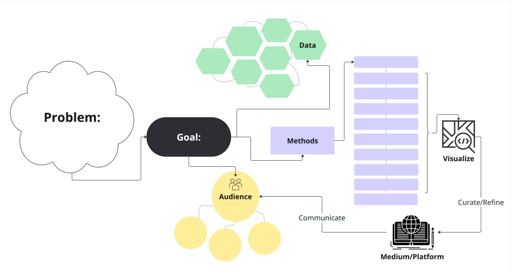
- Problem: Use geospatial thinking to identify and articulate the problem you hope to address. This often starts with an observation that you would like to explore. The problem descriptions include the intended study area, your assumptions, and your goals.
- Context: The context includes defining your audiences. Who cares about this problem and what is your relationship to them? How do you anticipate impacting this audience and how do you imagine you could best present the results to them?
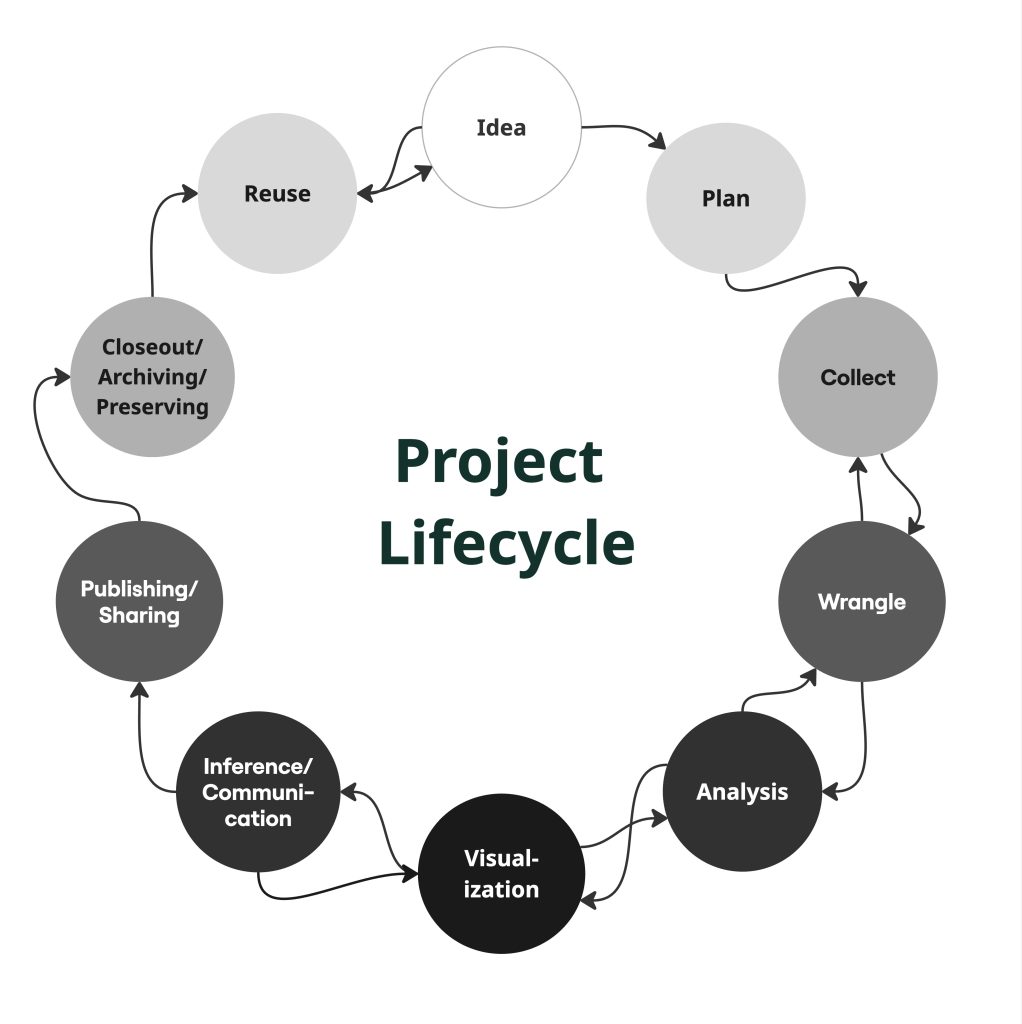
Illustration of a project lifecycle for data - Data: When creating your project plan, you don’t necessarily need to know exactly what data you’ll use. However, it would be helpful to outline the expected extent of your study area, if you will collect primary data (data that you gather from observation), what secondary data (data collected by someone else) will you use where will you look for it, and how will you evaluate it to make sure it’s reusable.
- FAIR is a helpful framework for evaluating secondary data.
- Findable: it came from an authoritative data source, which you can cite
- Accessible: the repository uses open protocols
- Interoperable: the data and metadata are in open formats
- Reusable: the data are well documented so that you understand details about the data and variables. This includes any licensing restrictions. As mentioned in the data management chapter, a README file and data dictionary is important when reusing data.
- FAIR is a helpful framework for evaluating secondary data.
- Methods: This part of the plan describes what you want to explore at a high level. You may not know at this stage all the methods you’ll need, but you can map out major steps you know you will need to make: find data, wrangle data, geocode, join, etc.
- Communication: It’s essential to think back to your audience and what sort of communication will be most impactful. For example, it could be through a series of printed maps or it could be an interactive online map.
- Challenges: You might know going into a project that there are issues you will have to address in the project process. Some examples might be that you need to learn more about some aspect of the project, or that you aren’t sure if you will be able to find the data you need, and so your plan B might be proxy data or a different line of discovery.
Creating a diagram or a story board for your project is a great way to work through the project plan.
Part 1, Exercise 6: Project Scenario
Exercises
Exercise 6: Map out project problem you would like to plan on your own.
Brainstorm a geospatial thinking problem. Fill as a much of the of the plan as you are able. You can come back to this exercise as we work through Part 2.
