
Chapter 8: Planning Scenario
Project Summary
Problem
I want to evaluate household demographics, zoning, and housing values in St. Louis County’s inner-ring suburbs in the year 2010. I’ll also look at other natural characteristics of areas, such as sinkholes and flooding.
Goal
Create an exploration between demographic, economic, and natural characteristics.
Context
As a resident of an inner-ring suburb of St. Louis, I would like to understand varying characteristics of the municipalities within.
Data Collection Pipeline
I will collect the following datasets:
- Census data for income and race (US Census Bureau)
- Parcel data for housing values (St. Louis County)
- Street centerlines (St. Louis County)
- Topographic data like contours and sink holes, flood plains (St. Louis County)
File Storage
- Active Storage: Local machine and cloud drive
- Backups in networked serves
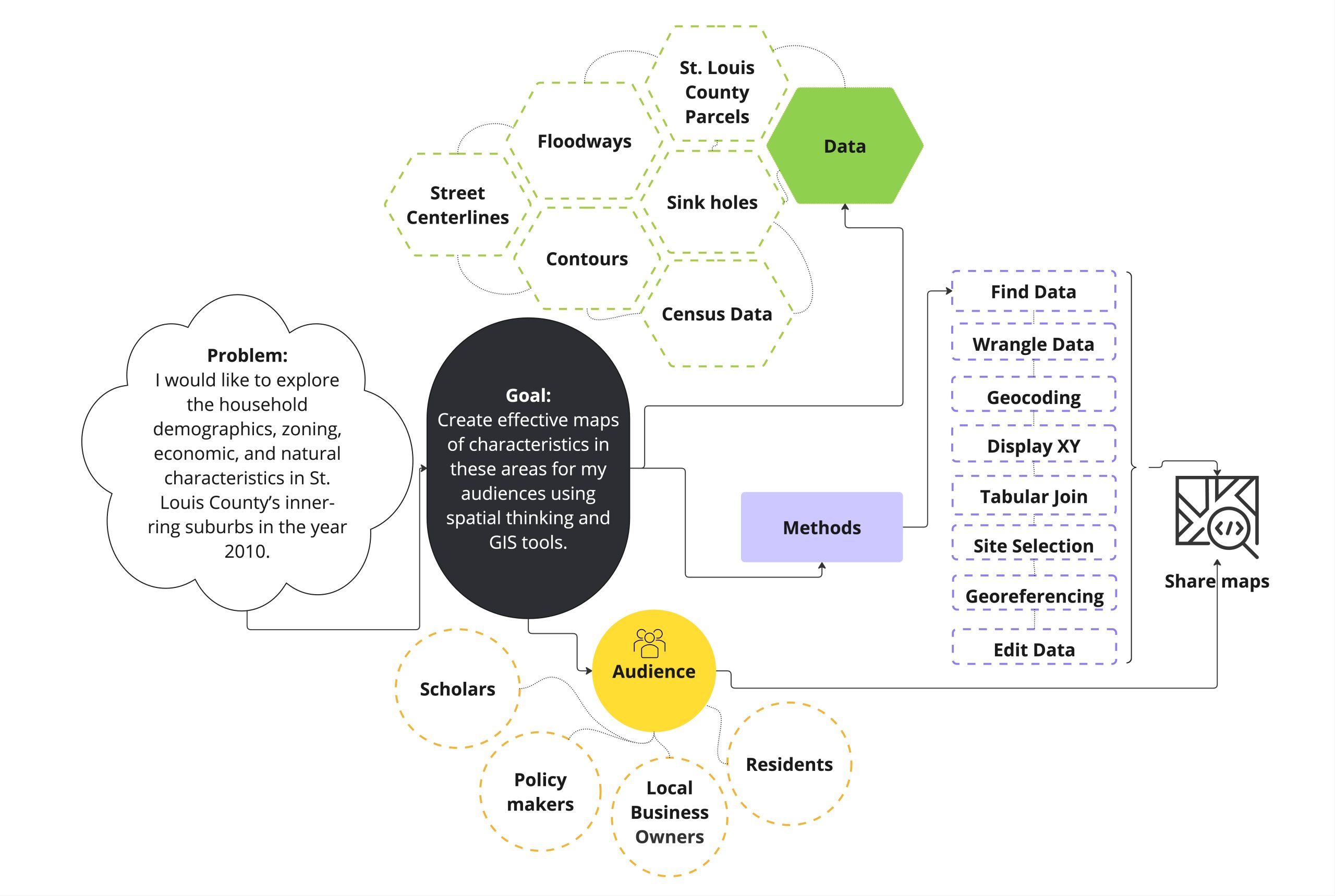
Completed project diagram.
Analysis Methods
- Find data, evaluate it for authenticity and appropriateness
- Clean tabular data for use in GIS
- Geocode address and/or display X,Y data.
- Join tables to feature layers
- Selection by attributes and location
- Buffer features
- Classify data
- Kernel Density Estimation
- Layout
Communication
- Create several maps that can viewed online or printed.
Challenges
- Finding the right data and processing it for use.
