
Chapter 15: Buffer Analysis and Points in Polygons
Create a central point from which to buffer
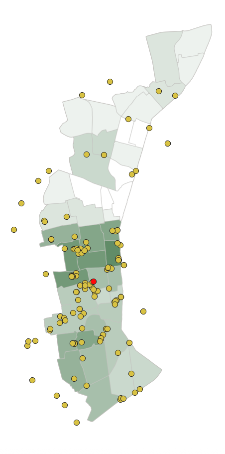
Before we create our buffer, we will find the geographical center of our businesses. To do this we will calculate the mean coordinates, which computes a point layer with the center of mass of geometries in an input layer. Doing this computation will provide us a a center point for our buffer.
Step 1: From the vector menu, go to analysis
- Select mean coordinates
- Input layer: innerring_businesses
- Weight: none
- Unique ID: none
- Mean coordinates: create temporary layer
- Open output file after running algorithm
- Run
A feature (red in the image) will appear at the center of the innerring_businesses
Step 2: Buffer the central point.
We might like to know how many businesses fall within the center. To do that we can make a radius around the central point.
- From the vector menu go to the geoprocessing tools
- Select buffer
- Input features: mean coordinates
- Distance: 2 miles
- Segments: 25
- End cap style: round
- Miter: default
- Run
Step 3: Count points in polygons
- Go to the vector menu, analysis, Count Points in Polygons
- Polygons: buffer
- Points: innerring_business
- Weights: none
- Class field: none
- Count fields name: NUMPOINTS
Step 4; Buffer floodways
- We might also like to know what parcels are falling near t flood zone. We’ll also buffer the flood way.
- Go to the vector menu, geoprocessing tools, select buffer
- Input features: innerrring_fldwy
- Distance: 200 feet
- Segments: 25
- End cap style: round
- Miter: default
- Run
Step 5: Now we’ll find parcels that fall into the 200 foot buffer
- Select by location
- Select features from: Innerring_sf_parcels
- Where the features are within
- Comparing to: fldwy_buffer
- Run
If you open the attribute table, you can see 3764 parcels fall in that buffer.
Step 6: Export the fldway_parcels
We have exported data many times up to this point, repeat those steps.
